GPS Distance Land Area Measure
Version:13.0
Published:2025-03-12
Introduction
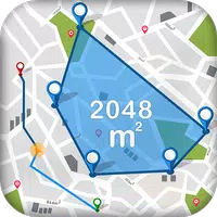
GPS Distance Land Area Measure is a fantastic tool for accurately calculating distances and land areas. With the ability to easily measure any place or land area on a map from your current location, this app offers convenience and precision. Whether you need to determine the size of a specific area or calculate the distance between two points, this app has got you covered. With user-friendly features like saving measurements, adding images, and locating Points of Interest (POI), GPS Distance Land Area Measure is a must-have for anyone who needs to measure and calculate distances and land areas with ease.
Features of GPS Distance Land Area Measure:
Measure any area accurately with GPS or manual methods
Calculate distance between two or more points anywhere on earth
Easily mark and correct points for measurement on the map
Save and enhance measurements with names, descriptions, and images
Locate Points of Interest (POI) and save their latitude and longitude
Switch between map types for added convenience
Conclusion:
GPS Distance Land Area Measure is a user-friendly and efficient tool for measuring distances and areas on a map. With features such as accurate measurements, easy point marking, and saving options, users can easily track and calculate distances and land areas. Additionally, the ability to switch between map types and save POI locations makes this app a comprehensive tool for various measurement needs. Download GPS Distance Land Area Measure now to measure distances and areas with ease and precision!
Show More
Information
Screenshots


Latest Update


Hot Tags
Latest News
-
![Revealing the Launch Playlists and Cross-Progression for COD Warzone Mobile News]()
-
![March 2024 Free Redemption Codes for Honkai: Star Rail News]()
-
PUBG Mobile Teams Up with Bentley Motors: Luxury Cars, Exclusive Collectibles, and Beyond 2024-04-18
![PUBG Mobile Teams Up with Bentley Motors: Luxury Cars, Exclusive Collectibles, and Beyond News]()
-
![Monster Never Cry is now accessible on both Android and iOS mobile devices. News]()
-
V2.2 of the Farlight 84 update introduces an overhauled Season structure, fresh in-game currency, an 2024-04-16
![V2.2 of the Farlight 84 update introduces an overhauled Season structure, fresh in-game currency, an News]()
-
![Arrival of Genshin Impact 4.6 Update: 'Embers of Two Realms, Twilight of Crimson' News]()
-
April 2024 Clash of Clans Update: Unveiling a Fresh Companion, Enhanced Levels, Chat Tagging, and Be 2024-04-16
![April 2024 Clash of Clans Update: Unveiling a Fresh Companion, Enhanced Levels, Chat Tagging, and Be News]()