
LEOTrack: Satellite Tracker
Version:1.0.7
Published:2026-10-24
Introduction
LEOTrack: Satellite Tracker is a lightweight Android app that tracks low-Earth-orbit satellites in real time, providing pass predictions, live sky maps, and notifications for visible flyovers. It blends intuitive maps, orbital data and practical alerts to help hobbyists, photographers and students find satellites above their location quickly.
Core features and tools
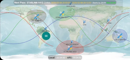
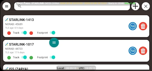
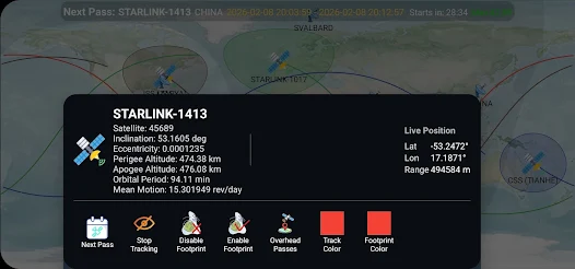
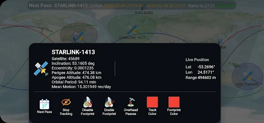
LEOTrack: Satellite Tracker offers a clear set of tools for following satellites and planning observations. Live orbital traces show current position and future ground tracks, while pass prediction calculates when a satellite will rise, reach maximum elevation and set. Adjustable visibility filters highlight only bright or sunlit passes. The app also supports search by satellite name or NORAD ID, and it downloads updated orbital elements to keep predictions accurate.
Interactive maps and viewing modes
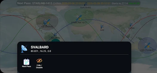
The app combines 2D map and sky-view displays to match different observation styles. Use the overhead map to watch a satellite’s ground track, switch to a star-chart-like sky view for point-and-find guidance, or enable an augmented reality overlay so your device screen lines up with the real sky. Map layers let you toggle country borders, city lights and horizon lines for better context.
Customization and alerts
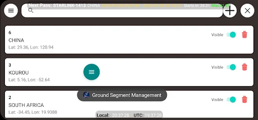
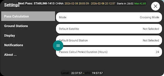
Customize notifications and observation settings to suit your schedule. Set alert thresholds for elevation and brightness, choose reminders a few minutes before a visible pass, and create watchlists for favorite satellites. Widgets provide at-a-glance pass times on your home screen, and calendar export makes it easy to add observation events to your personal schedule.
How the tracking engine works
The tracking core relies on regularly updated orbital element sets to propagate satellite positions. LEOTrack: Satellite Tracker pulls these updates automatically and uses them to forecast trajectories and visibility windows from your current GPS-derived position. Calculations take into account local horizon, sun position and the satellite’s illumination to predict whether a pass will be visible from your location.
Practical use cases
- Amateur astronomers can plan viewing sessions and coordinate with star parties by sharing pass times.
- Photographers can time long exposures to capture satellites or the International Space Station crossing a scenic foreground.
- Educators and students can demonstrate orbital motion and predict satellite encounters as part of hands-on lessons.
Performance and compatibility
Designed to run smoothly on a wide range of Android phones and tablets, LEOTrack emphasizes efficient battery use and responsive map interaction. Data caching reduces repeated downloads for commonly viewed satellites, while background update options let you control network and battery usage. The interface remains usable on smaller screens, and support for higher-resolution displays ensures crisp sky charts on modern devices.
Privacy and permissions
The app requests only the permissions necessary to provide core functionality: location for accurate pass predictions, network access for orbital updates and optional camera access for augmented reality mode. Offline caching minimizes repeated network activity, and user preferences allow you to limit background updates or disable data sharing features.
Getting started
Begin by granting location permission so the app can calculate passes tailored to your position. Browse the satellite catalog or enter an identifier to add objects to your watchlist. Toggle map layers and set notification thresholds to receive alerts when a visible pass is approaching. A short in-app tutorial guides new users through the main views and settings.
Tips for better observing
For best results, calibrate your device’s location and orientation before attempting augmented reality guidance. Check the predicted elevation—passes above 30 degrees are easier to spot—and account for local light pollution. If you plan a photography session, use the app’s calendar export to coordinate with golden hour and moon phase tools.
LEOTrack: Satellite Tracker streamlines the process of finding and tracking low-Earth satellites with practical features, clear visualizations and configurable alerts. Whether you want to catch a bright flyover, record orbital motion, or teach others about satellites, the app provides the tools to plan and execute successful observations.
Show More
Information
Screenshots
Latest Update










Hot Tags
Latest News
-
![Revealing the Launch Playlists and Cross-Progression for COD Warzone Mobile News]()
-
![March 2024 Free Redemption Codes for Honkai: Star Rail News]()
-
PUBG Mobile Teams Up with Bentley Motors: Luxury Cars, Exclusive Collectibles, and Beyond 2024-04-18
![PUBG Mobile Teams Up with Bentley Motors: Luxury Cars, Exclusive Collectibles, and Beyond News]()
-
![Monster Never Cry is now accessible on both Android and iOS mobile devices. News]()
-
V2.2 of the Farlight 84 update introduces an overhauled Season structure, fresh in-game currency, an 2024-04-16
![V2.2 of the Farlight 84 update introduces an overhauled Season structure, fresh in-game currency, an News]()
-
![Arrival of Genshin Impact 4.6 Update: 'Embers of Two Realms, Twilight of Crimson' News]()
-
April 2024 Clash of Clans Update: Unveiling a Fresh Companion, Enhanced Levels, Chat Tagging, and Be 2024-04-16
![April 2024 Clash of Clans Update: Unveiling a Fresh Companion, Enhanced Levels, Chat Tagging, and Be News]()